Crowd2Map Tanzania has been mapping rural Tanzania into OpenStreetMap since October 2015. We have trained over 17,000 remote mappers from all over the world to map from satellite images and over 3000 field mappers to add their local knowledge to these base maps, mostly using the free smartphone app Organic Maps.
We have also set up Youthmapper chapters in 16 different colleges in Tanzania.
Having better maps is vital in the fight against Female Genital Mutilation (FGM) and to help community development. We support many grassroots organisations in rural Tanzania, such as Hope for Girls and Women Tanzania, to use maps and data collection to make themselves more effective.
Crowd2map was founded by Janet Chapman, Chair at the Tanzania Development Trust, and Egle Marija Ramanauskaite after they met at the Mozilla Festival 2015 and began exploring ways to make areas of Tanzania more accessible through mapping. (Egle left the project in 2017 due to pressures of work.)
Key members
Gabor Bakos, GIS Data Scientist
Gabor joined Crowd2Map with the vision and drive to improve upon our Non-Profit Organization, and focused on developing the organization with experience and integrity.


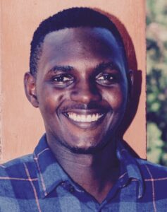
Herry Kasunga, GIS Analyst
Herry Kasunga is a Tanzanian GIS analyst, who is volunteering at the Hope Safe House in Mugumu, and training the Digital Champions and Youthmappers there. He is eager to make a positive change in his country by using GIS techniques and tools and sharing his knowledge with the community to deliver the Sustainable Development Goals.
Erick Tamba Mnyali Environmental scientist | Researcher
Erick is a researcher, environmental scientist serving as a YouthMappers regional ambassador. He is supporting YouthMappers chapters in the East African region and strives to share his skills on the use of open-source GIS tools with the local community to support data-based decisions and solving community challenges.
Emmor Nile
Emmor Nile is a forester by training, with many years of image interpretation and GIS experience. Emmor has lived in East Africa, has helped organize two State of the Map Africa conferences and supports Crowd2Map as a GIS Corps volunteer in GIS analysis, HOT project planning and creation, and project task validation.
