New cohort of interns join us from 6 countries

By Janet CHAPMAN – Project Leader

Last year we hosted our first cohort of interns recruited as part of the Youthmappers Everywhere She Maps initiative which was a great success. You can read quotes from some of the participants here.  Building on that we were delighted to recruit 12 more Youthmapper interns for our second cohort.who started at the beginning of October. They come from 6 different African countries and we organise training via Zoom and WhatsApp delivered by their mentor GIS specialist Herry Kassunga and variious outside experts. They also participate in training delivered as part of the Humanitarian OpenStreetMap Data Interns program.

We are continuing with our monthly mapping groups training, and have set up a new group in Shinyanga.  We are also mapping school journeys with Ikondo School in Kagera, who have particularly dangerous routes during the rainy season as you can see in this photo.  

We are also now mapping in Singida in the area around the village development project we are about to start in partnership with EuCanAid. This will bring access to water, a clinic, and improvements to the primary school in Mduguyu village. This area was very poorly mapped so we set up this project and have been training field mappers to add their local knowledge.  We will then produce village and district level maps for the community. 

We are also continuing to map areas where girls are at risk of FGM, particularly in the lead up to the cutting season expected in December. 

Finally we are busy helping organise the second State of the Map Tanzania conference. This will be a hybrid conference so we hope many of you will be able to join from wherever in the world you are – we already have a brilliant range of speakers confirmed, and the call for talks is still open. 

Thank you again for your generosity which enables this entirely volunteer run project to keep going.

You can donate on our Global Giving page

State of the Map 2022

Reflections on our 4th State of the Map Firenze

It was wonderful, if slightly overwhelming and sometimes surreal to finally meet so many fellow mappers again at SOTM Firenze last week, as well as so many new friends that I’d only interacted with online. This was my 4th in person event and it reinforced not only how much Crowd2Map has grown since Brussels 2016 but also how the mapping community has changed.

State of the Map 2022

In 2016 arrived in Brussels late at night, a bit disconcerted to find that I was sharing a bed with a stranger – Miriam from GeoChicas. We quickly got over this surprise and she became a great friend and ally, even visiting the FGM Safe Houses we work with in Tanzania en route to FOSS4G 2018. In Brussels I was a newcomer who knew no one. I tried to navigate the seeming chasm between the brown shirted craft mapper gang and the humanitarian team. In Firenze I was very pleased to note much less of this divide. Arriving felt like coming home after a long journey, meeting so many people from previous events and others for the first time IRL.

Particular highlights for me were talking about the impact of our Digital Champion project, meeting colleagues from Missing Maps HOTand Youthmappers who I’d only interacted with online. Kristen Tonga’s talk on the challenges of mobile mapping in rural Tanzania really resonated with our experiences setting up our Digital Champions program, and we look forwards to working with her going forwards.

Ilya is always enthusiastically working on something interesting and this year was no exception, we’re looking forwards to working with him on Every Door soon. The We’re also looking forward

We were particular proud that Binyam Dele Youthmapper Ambassador from Ethiopia wants to replicate our work fighting FGM there.

Greatly looking forward to next meet up – particularly State of the Map Tanzania in January 2023 and hope to see many of the mapping community there either in person or online!

As Crowd2Map turns 6, we celebrate the work being done to empower rural communities in Tanzania

Crowd2Map Tanzania has a cohort of 16,000 volunteers based in Tanzania and around the world, all of whom are driven by a passion to help rural communities in Tanzania and to ensure girls and women in these areas are empowered. As we celebrate 6 years of mapping, we take a look at some of the work and partnerships that we have developed to ensure Tanzania is mapped.

Crowd2Map Tanzania has been training local activists (NGOs), Local Government, communities and Youth Mappers Chapters in Tanzania on open data and mapping and how can they integrate mapping knowledge with their activities to solve community challenges.

Some of the tools used for mapping and open data that Crowd2Map has been training these group on are:

  • Smartphone applications such as Maps.me, OSMAnd, ODK and Mapillary for mapping features around their community and collecting data for different uses
  • Other tools that require the use of a computer for mapping and Data collection such as ID Editor, JOSM and Kobo toolbox

Some of the NGO’s have managed to win Community mapping microgrants and are running projects in their communities in various areas in Tanzania to share mapping and open data knowledge with a wider audience.

Tanzanian NGOs who have been trained include:

  • Agri-Thamani based in Bukoba Tanzania are running garden community mapping and Schools mapping project in their community
  • Red Cross Katavi community are mapping vulnerable areas around Mine sites in Katavi
  • Good Harvest Organization who were trained in the use of Open Data Tools and other internet-enabled devices
  • LAVISHENI group in Mwanza mapping vulnerable areas for GBV cases in their community
  • Institute of Rural Development and Planning College in Dodoma Youth mappers are mapping Dump sites in Dodoma
  • Serengeti Tourism College Youth Mappers are involved in mapping health centre facilities in Mugumu-Serengeti

Institute of Accountancy in Arusha (IAA) Youth Mappers, Tumaini College in Arusha Youth Mappers, Institute of Rural Development and Planning Youth Mappers in Mwanza are still continuing with mapping Training.

Miller’s Group in Muleba Tanzania, Kibondo mapping Group, ESTL NGO are still continuing with mapping and Open Data training.

Local Government in Serengeti and Singida are now involved in mapping and Open data training conducted by Crowd2Map.

We are seeing a great deal of interest from these local and broader organisations who are understanding of the benefit of accurate maps for the growth of Tanzanian communities.

You can watch the recording of our 6th birthday event here (you will be taken to YouTube).

If you are interested in becoming a volunteer, you can find out more and get involved here.

Missing Maps is 5

When I first realised the need for maps in Tanzania 4 years ago and started Crowd2Map I had not heard of Missing Maps. However about 3 months in I came across the very active and friendly London group which I have been attending fortnightly ever since, and their support and advice has been invaluable.  This week Missing Maps turned 5, a time of reflection for the founders including Ivan Gayton.

He originally envisioned it as a finite endeavour that shouldn’t last more than 4 years, and states “The idea was: what if instead of relying on media coverage of crises to generate volunteer engagement to map after disasters had already struck, we used the power of humanitarian movements to build a community to map the homes of vulnerable people before disasters?

In Haiti in 2010, using OpenStreetMap data was an interesting new idea, practiced by a couple of innovators alongside the “proper, professional GIS” being done by the cluster coordination. By the time Typhoon Haiyan hit the Philippines in 2013, OpenStreetMap was at least co-equal with the closed data. In the West African Ebola outbreak in 2014 open, community-generated map data was unquestionably the dominant source of geographical information. Open map data is now the default for humanitarian and crisis response.

So why didn’t we declare victory and move on? Why do we still need the Missing Maps? Because what I had originally seen as success turned out to be no more than a starting point. I had failed to anticipate the range of uses for open map data. I was focused on patient origins and spatial epidemiology—still critically important but not the only impactful use—and did not realize the importance and possibilities of locally-driven field mapping. The remote volunteering and mapathons, which attracted a startlingly diverse and extraordinarily passionate volunteer community, have now largely accomplished the original goal of creating the base-map vector features in some places. There’s more to be done, to be sure, but the key gap in many places is no longer digitization, its local knowledge and ways to operationalize the data.

The ultimate goal of humanitarian action is to save life, alleviate suffering, and restore dignity. Mappers cannot claim to save lives directly; if we are to have an impact it is by facilitating those who are saving lives (or helping themselves). To reach its full potential, the Missing Maps must not only provide basemap data, but to enrich them with local knowledge and see that the maps are put to use.

I now see three phases of Missing Maps action:

1) Create a base layer of vector data across the most vulnerable areas of the globe using digital volunteers

2) Infuse local knowledge into the map using field mapping campaigns in collaboration with local people (the most critical local knowledge being local place-names, landmarks, and administrative divisions—without which we cannot disambiguate locations described by people in their own words).

3) Actively partner with people working to save lives, alleviate suffering, and restore dignity to make them more effective using our data, skills, and knowledge.

The Missing Maps has basically succeeded at phase one in many places. Phase two is in progress; many of us are increasingly engaged in work with local communities to add the local information to the map that makes it useful and relevant to people working in these contexts. Phase three has, in my view, not yet even properly begun. Sure, a few well-funded agencies have better GIS support as a result of the Missing Maps, and there are sporadic uses of Missing Maps data arising spontaneously here and there throughout the humanitarian field, but humanitarian action and crisis response are still nowhere near achieving the additional effectiveness that a truly inclusive global community of mapping practice could provide.

For example, in the current Ebola outbreak in the Democratic Republic of the Congo, patient origins are still poorly understood. This is not even to speak of the colossal gap in disease surveillance throughout the low-income world, the lack of accurate demographic data for public health and services, the desperate lack of transparency in land titles, or the difficulty in navigating the more or less informal settlements that one-quarter of humanity live in. The Missing Maps should be saving and improving many more lives. It can do so once we are working directly with people on the front lines, understanding their problems and constraints, and working with them to operationalize map data.

There are hundreds of thousands of health centres in Africa awaiting the support needed to properly understand their patients’ origins and act upon them to reduce disease burdens. There are aid agencies, civil servants, private businesses, taxi drivers, public health ministries, environmental activists, scientists, farmers, and pizza delivery bicyclists waiting for our help (in some cases whether they know it or not). The Missing Maps must become much more than a digital volunteer community, it must become an inclusive global movement to empower all of the things that save and improve lives.

Finally, maps themselves can in some small way contribute to human dignity. To be on a map is to be acknowledged, is to be known, is to be recognised, is to be counted. It is for the world to know that you are there and that you have needs, that you have rights, and that you must not be forgotten or passed over. This requires more than a nice map on the Web made by digital volunteers and aid agencies, it requires working together with the inhabitants of the previously neglected places in the world. Five years in, the Missing Maps has seen success beyond our wildest dreams. But it turns out the work is just beginning, and we must go beyond our original digital volunteering mandate to achieve our full potential. Let’s get to it, shall we?”

Thank you to Ivan for expressing the rationale behind Crowd2Map so clearly.  We want to partner with anyone interested in mapping for development in Tanzania and beyond – so if you any suggestions please do get in touch. 

Circling the World with OpenStreetMap

Imagine that you are able to look down from a great height, over any region of the world, and view villages and farms in great detail. You might see, for example, what appears to be a well-trod footpath that bypasses a shed or a goat pen, or a building tagged as a school but with no playground or soccer field.  You see no paved roads or sidewalks.  What would it be like to exist in this world that you are viewing? 

Mapping on OpenStreetMap (OSM) offers a challenge.  But anyone who has experienced it can testify to how it magically takes us to unfamiliar corners of the world to peer into remote towns and villages.  It offers us a view into the lives of people who not only look different from ourselves but who might also be living on the edge of starvation.  In a humanitarian context, the experience of mapping can be transformational, especially when used to help at-risk populations, such as the young women of Tanzania.    

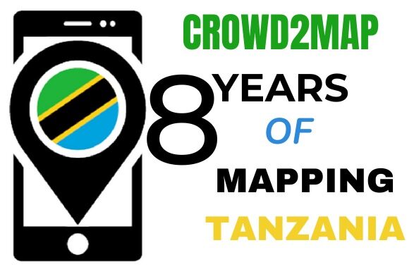
Mapping to End Female Genital Mutilation

Although the practice of female genital mutilation (FGM) remains illegal in Tanzania, many young Tanzanian females, especially those living in remote regions of the country, are subjected to this practice.  This past September, Janet Chapman gave a presentation at the State of the Map (SOTM) Conference in Heidelberg, Germany, on the progress being made on Crowd2MapTanzania

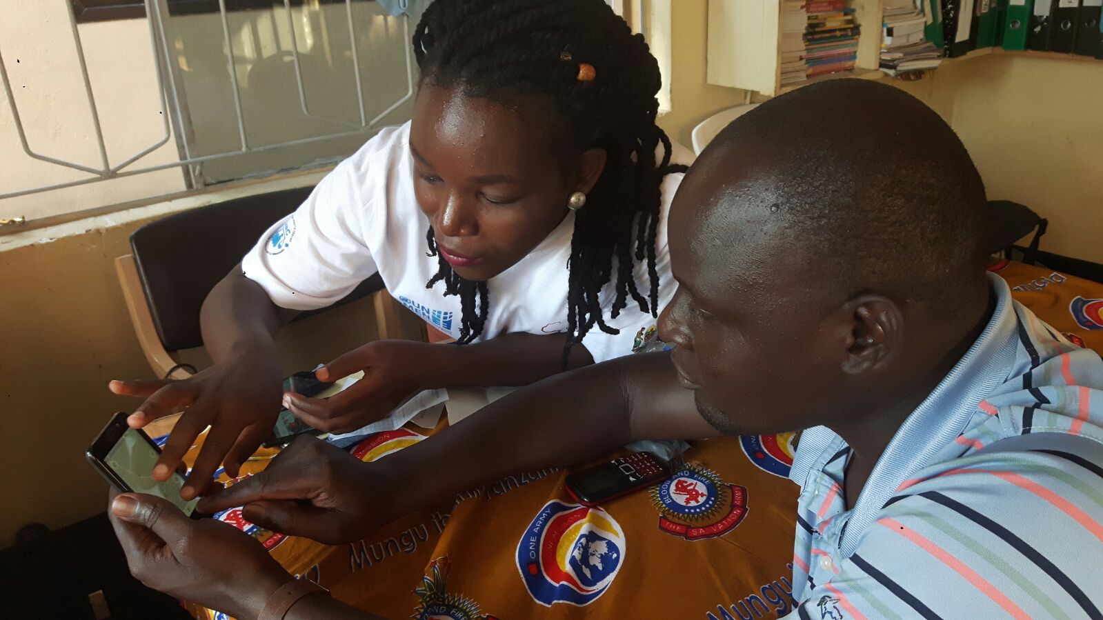
One of Crowd2Map’s primary goals is to protect girls against FGM, and the initiative has made remarkable progress.  Nearly 12,000 volunteers around the world have already added 3.6 million buildings to OpenStreetMap (OSM), using satellite images to trace buildings.  These remote volunteers access the Slack Channel, which now has 3,000 members, to ask questions or receive feedback.  On the ground in Tanzania, over 1,600 activists use smart phones to add villages, schools, hospitals, clinics, offices, shops, churches, and safe houses to the OSM maps.  

As a Trustee of Tanzania Development Trust and its Communications Manager, Janet has been spending at least two months a year in Tanzania for the last six years. From her time on the ground, it was clear to her that mapping was badly needed.  So, in November 2015, she founded Crowd2Map Tanzania to protect Tanzanian girls from FGM but also to promote community development.

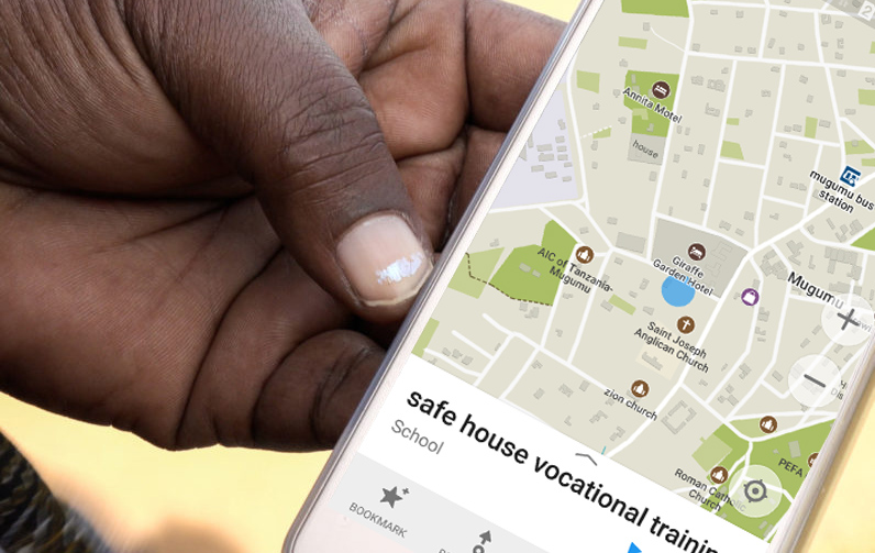
Past efforts to provide protection and support to girls at risk of FGM have always been greatly “hindered by lack of mapping,” Janet noted, and that lack has made regional travel difficult.  “Without maps, young Tanzanian girls cannot find safe houses, and sanctuary from FGM practices. And safe house staff members and police officers cannot find girls at risk for FGM.”

One of the principal activists on the ground in Tanzania is Rhobi Samwelly, who set up the Mugumu Safe House, where girls can find safety and support.  Rhobi herself could have died from FGM.  “When she was cut at the age of 13, Rhobi almost bled to death,” Janet told her audience in Heidelberg. “Her girlfriend had been cut and she died, and her body was left in bushes surrounding the village.” 

Because it is illegal, the practice of cutting is largely performed without medical personnel present. Rhobi’s ultimate goal is to place an activist in all villages, so that the village activist can become someone girls at risk will turn to for protection and transport to a safe house.   For further information about FGM, see 28toomany.org/country/tanzania.

State of the Map (Heidekberg 2019)

Like other 2nd generation World Wide Web tools, OSM draws much of its influence from community participation around the globe.  Representatives from humanitarian, recreational, governmental, and academic attended the 2019 State of the Map Conference in Heidelberg to present their work and share their concerns.

“I’ve been involved in the OSM community for four years now,” reports Janet Chapman, and it was fantastic to meet up with people in Heidelberg who I generally only see once a year at such events and find out how their work is progressing. 

 “Plus, I had the opportunity to meet new people who are also doing amazing things, she added.  “One of the projects we are most interested in is the use of machine learning to speed up the mapping process.  We have already set up some pilot projects and are excited about the results.  We will start rolling this out soon, on wider basis.”

Before exploring how machine learning, (a type of artificial intelligence based on patterns and inference, using algorithms and statistical models) will transform mapping, let’s briefly review some of the numerous OSM mapping projects presented at the SOTM Conference.

Cycling

Those interested in urban and touring biking had excellent opportunities to connect, learn, and share concerns.  For instance, a group of activists from Medellin, Columbia, shared their work on mapping the cities of the Aburrá Valley, with Medellin as a core city. Drawn in part from the GEOLab Research group at the University of Antioquia, these cycling activists are using OSM to map existing infrastructure and provide visualization of safety data (including air quality), with the goal of making cycling safer and more attractive.

Likewise, representatives from Nomad Maps talked about their goal of creating a community of “NomadMappers” in Columbia, Ecuador, and Peru. They will map on both OSM and Mapillary in order to assist cyclists in their travels across the Andes Mountains.    

Members of CyclOSM presented their cycling render of Paris, which built on the excellent quality of OSM’s Paris data.  Their work differentiates bidirectional ways and dedicated lanes versus shared lanes (bike lanes are often indistinguishable from car lanes), and also pinpoints bumps and bike boxes. 

Indoor and Outdoor Walkways

Mapping pedestrian walkways and paths presents challenges. Hikar, an augmented reality app for Android, is experimenting with the use of augmented reality in conjunction with OSM.  Once restricted to England and Wales, Hikar now covers Europe and shows distance and direction. 

On-the-ground navigation for those with mobility impairments, presents a different sort of challenge.  In England, the Stockport Council initiated the ‘Mapping Mobility Stockport’ project to address navigation barriers to individuals with vision impairments or wheelchairs.  They collaborated with community members to develop strategies for negotiating such barriers, thus transforming the project into a share community effort. 

The French railway company SNCF has created a dedicated routing engine to navigate indoors and outdoors at 83 train stations in Paris.  SNCF has also incorporated landmarks (replacing certain written instructions) onto their railway station maps.           

Public Transportation

SNCF has adapted GraphHopper, used primarily for graph-based car, pedestrian, and bike navigation, to work with OSM rail data.  SNCF calls their initiative OpenRailRouting, and it has resulted in upgraded services, such as delay calculations, tunnel positioning, and distance calculation.  

In Norway, Entur maintains a national registry of data for 60 public transportation operators, using OSM as a foundation for routing.  Entur plans to broaden its scope to all of Europe and will continue to build on its use of OSM, OpenTripPlanner, and other open-source platforms to do so. 

Community Development and Disaster Preparedness

In central Scotland, the Falkirk Council used OSM to create Our Falkirk.  Poverty estimates run as high as 25% in Falkirk, and their map-based tool provides information to the community on local services that provide social support, food supplies, financial advice, and digital access.

OSM is being used to determining the need for bridge infrastructure in the Kingdom of eSwatini.  To determine the need for additional bridges, the region’s baseline accessibility (to a bridge) is compared to its accessibility during a flood or rising water levels.  Similarly, OSM is being used in Nepal and in the Philippines, to strengthen disaster preparedness. 

Artificial and learned intelligence Support Each Other on OSM

The inclusion of the Academic track in the annual SOTM Conference provides a look at some interesting research on the effects of mapping on volunteers, using YouthMappers as subjects.  According to Patricia Solis, such research suggests that the humanitarian nature of many mapping tasks often softens the grinding task of learning a new technology, making it a more compelling challenge.  Because humanitarian mapping often awakens volunteers to the ordeals in other people’s lives, the experience itself often leads to more positive outcomes, such as satisfaction or a newly found interest in technology.  Research also indicates that the experience of mapping helps develop valuable geospatial skills in young people, skills may help them land an internship or job offer, according to Patricia Solis and Sushil Rajagopalan.  They indicated that the effects are particularly strong for females.

Equipping a younger generation with geospatial skills, already highly valued in the marketplace, may be greatly enhanced by the expansion of OSM’s functionalities with machine learning.  In July of 2019, Facebook released Map With AI, which is now available to OSM and provides access to Tanzania (as well as Mexico, Nigeria, Uganda, Indonesia, Bangladesh, and Afghanistan). 

Map With AI comes with an AI-powered OSM editing tool called RapiD, which acts as its interface.  Like flipping a switch to turn on the overhead lights, mappers will use RapiD to review the model’s identified navigation patterns of paved and unpaved roads and paths (as opposed to dried up riverbeds) and highlight them on OSM.  The identified, or “predicted,” roads and paths are given a confidence rating, which is expressed as a magenta overlay.  Existing roads show up with a white overlay.

Tested by Facebook and OSM reviewers on 300,000 miles of unmapped roads in Thailand, the Map With AI has been shown to accelerate the process of road mapping. Given the extent of the numerous mapping projects, and the education it is providing in geospatial skills, Facebook’s AI model can only enhance and accelerate OSM’s crowdsourcing work around the globe.

Reflecting on the inspiring ICPD25

ICPD25 in Nairobi was an amazing event and I was extremely proud to run a Female Genital Mutilation (FGM) mapathon there on behalf of United Nations Population Fund (UNFPA). 9500 people from 170 countries attended the summit, from heads of state and UN employees to grassroots activists. 

I attended some amazing talks and workshops which included huge declarations from the Kenyan President to end FGM by 2022 and much smaller events. I met with familiar activists I’d spoken to before plus many new people with additional opportunities for collaboration. Some highlights for me included:

·       Rebeca Gyumi talking about her social media campaign against child marriage and FGM in our mapathon

·       Finally meeting Francis from The Network against Female Genital Mutilation (NAFGEM), who was talking at the Human Library about the value of generational dialogues in eliminating FGM

·       Hearing Tony Mwebia talk about his initiative #MenEndFGM and helping many of this group get started with mapping in Kenya

·       Meeting again Laura Mugeha and her colleagues from Women in GIS – doing amazing visualisations on gender – and persuading Laura to do a talk about Crowd2Map at State of the Map Africa, Ivory Coast (November 22-24) 

Plus very many contacts to follow up with. We have a busy few weeks through to the end of 2019 and will be proactively looking to get in touch with our new contacts as we move into 2020.

If you didn’t make it to the mapathon in Nairobi there is more information on the work we do with the support of volunteers around the world, on this site.  There is another online mapathon planned for 1st December and on 3rd December we will hold a mapathon in London, UK.

Map with us in Nairobi this November

We’re excited to bring mapping and our FGM campaign work to a global audience at the Nairobi Summit on ICPD25 in November. On Thursday 14th we will be running a workshop including a Mapathon which is open to attend to those already registered to the Summit.

2019 marks 25 years since the International Conference on Population and Development (ICPD) agreed a much-needed Programme of Action must be put in place, established by governments from 179 nations. The Programme of Action is an acknowledgement and understanding that reproductive health, women’s empowerment and gender equality form the pathway to sustainable development. This message is important globally and critical for communities across Tanzania and other East African nations and is being explored at the Summit.

Crowd2Map founder Janet Chapman along with Hope for Girls and Women founder Rhobi Samwelly will be delivering a mapping workshop at the Summit to share the impact this volunteer-driven pioneering digital activity is playing on the ground to help protect girls who are at risk of, or who have been through, FGM. With mapping also having been found to have a positive impact beyond FGM, this is an important stage on which to share the significance of the work we do.

Close up of mapping on a phone

We now have contributors from all over the world who are committed to bringing more visual guidance to those trying to reach and rescue vulnerable girls, as well as those wishing to escape challenging situations and beliefs. Tanzanians complete the process adding additional local knowledge and detail to the work delivered from afar.  With our effort in Tanzania proven to have been so successful, we are now keen to extend our mapping work to protect girls and women in communities further afield.

It promises to be an impressive event and we’re grateful and enthused to have this opportunity to bring mapping in front of a wider audience. Whilst there we will also meeting with FGM activists and looking to strengthen and broaden our network by meeting with other delegates.

Those wishing to attend need to be registered. More information about the Nairobi summit can be found at https://www.nairobisummiticpd.org/.

Follow us on social media to get updates on the run up and during the event. If you’re unable to attend the workshop but would like to meet at the Summit, please email j.chapman@tanzdevtrust.org.

We are Celebrating the 13th anniversary of OpenStreetMap with hopefully the biggest mapathon ever!

Crowd2Map with OpenStreetMap is inviting you to join us from every where in the world for hopefully the biggest mapathon ever! On August 13th, 11am GMT, we will celebrate 13 years of OSM, with local mapping parties & online !

We are trying to break the record of 1500 people in 24 hrs, so join & support us from wherever you are!! You’re invited to map one of these tasks: http://bit.ly/MapTanzania, although any point added in Tanzania with the tag #crowd2map in the 24 hour period from 11 am GMT on Sunday 13th August until Monday 14th August will count.

More information & registration here: 👇👇👇

https://www.eventbrite.co.uk/e/crowd2map-hosts-the-biggest-online-mapathon-ever-to-get-rural-tanzania-onto-openstreetmap-and-help-tickets-36751714367

We are in Kampala for the first State of the Map Africa!

This years State of the Map Africa will be taking place at Makerere University Kampala , Uganda East Africa, from 8th to 11th July 2017 .

Crowd2Map has been invited!

We will be presenting at 2 sessions on Saturday in which everyone is welcome to participate in remotely (both sessions will also be recorded).

The first is a Round table looking at Women in Technology and Mapping at 11.30 EAT. Register to attend the live stream here: https://www.eventbrite.co.uk/e/women-in-technology-and-mapping-session-state-of-the-map-uganda-tickets-35955408595

The second is our talk at 3.30 EAT and we will be presenting our experience of training community mappers in rural Tanzania as part of our HOT Microgrant. The link to join is here https://www.eventbrite.co.uk/publish?crumb=10b5dc45a29f39&eid=35955991338.

Talk Title: GROWING LOCAL COMMUNITIES OF MAPPING IN RURAL TANZANIA.

Date & Time:  July 8th, 15.30 (GMT+3)

Given by: JANET CHAPMAN.

Talk abstract: Crowd2Map is a volunteer run project mapping rural Tanzania, Since 2015 , we have recruited remote volunteers to map the areas of greatest interests via satellite imagery, and we have been training local communities to map their own villages with smartphones.

This year we have been awarded a HOT microgrant to support our community mapping efforts and provide local change agents with smartphones on short term loan .Many thanks to the HOT microgrant Team.

This talk will outline some of the issues and lessons to technology as well as given an overview of our research efforts to measure the impact of better maps in rural Tanzania.

Please join us if you can make it to State of the Map Africa this year, or remotely !

Safe House girls & crew getting engaged in our community mapping!

On Friday, 24th June, everyone around the Mugumu Safe House was getting involved with our community mapping programme that we were able to set up with the help of a HOT microgrant:

Below in the photo, Neema the Safe House social worker showing Ayubu how to access a map of Mugumu on a phone provided by the HOT microgrant. Although he is the Safe House driver he’s never used a map before.

IMG-20170624-WA0013.jpg
Continue reading “Safe House girls & crew getting engaged in our community mapping!”