Interested in Open Data or Coding? Join us at MozSprint in May!

We are delighted to have been selected to participate in the Mozilla Open Leaders programme, particularly as Crowd2Map started at Mozfest, (the Mozilla Festival) in 2015.  As part of that, we are taking part in #MozSprint, their global hackathon.  There are around 65 locations around the world taking part, and you can also participate remotely online.  If you are interested please register here. 

We are hoping to get more people involved generally in mapping, validating and spreading the word, but particularly in the more technical aspects such as helping improve the fieldpapers process, work out how best to incorporate machine learning into our mapping and how to better automate some of our processes.  Our repo is here.

So if you are interested in any of that please sign up and get involved!  And please spread the word in your networks too!

Open Data for Development event in Mwanza

To commemorate Open Data Day on March 3rd, Crowd2Map and Humanitarian OpenStreetMap Team(HOT) Tanzania organised a free 3 day training conference on how Open Data and Mapping using OpenStreetMap can aid development in Tanzania.  Over 90 people from across Tanzania attended the event at the Institute of Rural Development Planning in Mwanza, including community mapping groups from Kigoma, Kagera, Mara and other regions, students from IRDP Mwanza and Dodoma, as well as representatives from Tanzania Red CrossTanzania Wildlife ServiceUwezo and many other organisations.

The training was delivered by Amelia Hunt and Johannes Peters from HOT and covered topics such as what open data is available in Tanzania, what is OpenStreetMap and how it can help Tanzania; how to map your area using satellite images on a laptop; free apps on your phone; and printed Field Papers;and how to create printed village and district level maps. There were a combination of demonstrations, talks and practical workshops, including a session mapping in the field in the area around the campus.  Community groups who have benefited from phones and laptops provided by a HOT microgrant and the Nethope programme learnt how to make the best use of this technology to put their communities on the map for better navigation, planning and development of their areas.

There were also talks by Jonarda Ngissa from Uwezo  Tanzania on their citizen led educational assessments, and from Neema Meremo from Hope for Girls and Women Tanzania on how mapping can help protect girls from Female Genital Mutilation.

Evaluations showed that people had learnt a great deal from the training and comments included “it will help me be a better planner for my country”, “now I can teach others to improve our development” and “mapping is useful to indicate which water points are functioning, so we can improve access in Tanzania”.   Everyone indicated they would like further such training, and so we hope that many will be able to attend FOSS4G and HOT conference in Dar es Salaam in August.

Volunteering Opportunity for University Students

Are you in a Geography or International Development university department, wanting a real life example of how mapping can help rural African communities?

Who are we?

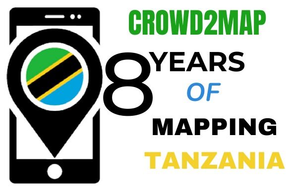
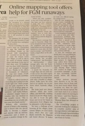
Crowd2Map Tanzania is an initiative created and managed by the Tanzania Development Trust. There are many missing maps in rural Africa. We have made it our mission to add as many OpenStreetMaproads and buildings to rural Tanzania.

Our goal

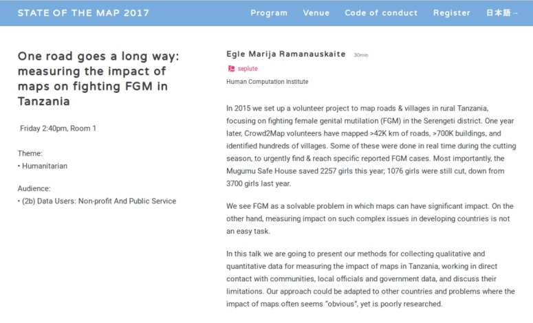
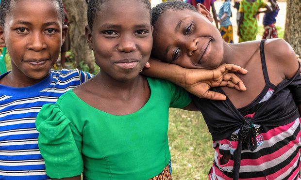
Our efforts have resulted in creating better maps which help humanitarian aid agencies, but especially vulnerable girls. Girls in Tanzania are at risk of being genitally mutilated (female gender mutilation/ FGM), and our maps help them find safer routes to and from schools.

Join us – fill in the form below please

How you can help

We offer you an opportunity to do remote (online) mapping (psst… there are additional, related opportunities when you join us). Whether you have 1 or 5 hours a week to assist us, we need you! Please join our growing community of international volunteers. Some of them are on the ground in Tanzania, and we’ll encourage you to work with them through our various communication channels. We use a combination of satellite and field mapping and validation in our approach.

What is in it for you?

As a student in geography, topology, geology; in humanitarian studies and international development work, you’ll be giving us the kind of insightful and motivated help we are looking for. In turn, we’ll reward you with a badge and/or certificate honoring your volunteering contribution. And: You will expand your international network online for future opportunities. Volunteering opens doors!

Additional opportunities

Once you connect with us, we’ll have further opportunities. For instance: You may want to deliver training sessions on OpenStreetMap. You may want to take part in our competition to create a printed map of a village. Or you may be interested in forming a YouthMapper chapter.

Come on… join us!

Welcome to the mapathon everyone!

We’re trying to break the record of the biggest mapathon ever for the 13th anniversary of OpenStreetMap, and it is now LIVE!

The mapathon will last until 11am UTC tomorrow (August 14). We are mapping here http://tasks.hotosm.org/?sort_by=priority&direction=asc&search=Tanzania+Development+Trust

There are instructions here: http://bit.ly/MapBuildings

PLEASE TRY TO ADD AT LEAST ONE BUILDING DURING THE NEXT 24 HOURS. AND TELL ALL YOUR FRIENDS!

We are hoping to beat the record for most mappers involved within 24 hours. You can check whether your edit has been counted. http://bit.ly/Crowd2MapTracker

We’re presenting at State of the Map 2017!

We are proud to announce that we will be presenting our research at the State of the Map 2017 – the global OpenStreetMap conference of the year!

Egle Marija Ramanauskaite, our Co-founder & Crowdsourcing scientist will present research on measuring the impact of maps in fighting FGM & supporting development in rural Tanzania.

Here’s the abstract:

Screenshot from 2017-08-06 07-10-59
Screenshot from 2017-08-06 07-07-18

If you’ll be there, join us the first day of the conference, 18th August, 2.40pm (GMT+9) in Room 1!

Janet Chapman returns from Community mapping in rural Tanzania

Our own Janet Chapman recently returned from our community mapping training in Tanzania curtsey of our Microgrant from HOT (Humanitarian OpenStreetMap).
Check this link for some of her updates.

She at the same time had a great chance to represent Crowd2map at the State of the Map Africa conference in Kampala July with more of her presentation .

hiaragirlpower.blogspot.ug Many thanks to HOT (HUMANITARIAN OPENSTREET MAP ) andSOTM (STATE OF THE MAP AFRICA).

Our latest statistics on crowd2map (by July 2017) Thank you all the mappers!

IMG-20170805-WA0006.jpg

Our latest updated mappers dash board herehttp://www.fragosus.pe.hu/volunteers/index.html

👇

We are currently mapping herehttp://tasks.hotosm.org/?direction=asc&page=1&search=Tanzania+Development+Trust&sort_by=priority

Kindly join in and crowd to map with us by following instructions in this attachment.getting-started-with-tanzania-project-2501

With a short video clip to follow;https://m.youtube.com/watch?v=Eg4mm7wu4RY&feature=youtu.be

Let’s work together to save lives by mapping to trace for and rescue the girls from Female Genital Mitigation in parts of rural Tanzania.