Training Village Women and Children Protection Committees with #WomenConnect

We are working with Humanitarian OpenStreetMap Team (HOTOSM) who were awarded a grant from the USAID WomenConnect programme to train women to better use digital technology to map and empower their communities which we started implementing this week.
mbalibali village map

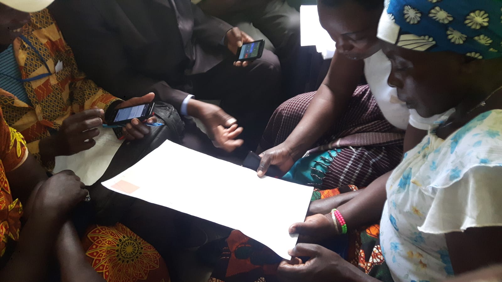
This involves visiting each of the 78 villages and holding a meeting with the committee members and showing them the map of their village that we had produced in OpenStreetMap.   This was the first time they had ever seen a map of their village and they found them fascinating.  We then showed them Maps.Me so they could see their location, zoom in and out and compare the digital version with the paper one.

We also trained the committee how to use smartphones as most of them had never used one before. They were very impressed by what they can do and loved the content we had downloaded onto sd cards, including Swahili videos about agriculture, FGM and womens’ rights.  We also showed them how to report incidents of gender based violence, GBV, using a form in OpenDataKit on the phone. As access to smartphones is so low in these communities, especially for women, we are leaving one phone per village to be used in the project.  We were able to do this because of a very generous donation from the FOSS4G conference in Dar es Salaam last year who were so impressed by our work.

Female Genital Mutilation and Gender Based Violence more widely are huge problems in Serengeti District, as in much of Tanzania, and are very under reported, particularly in these remote villages.

The Tanzanian government introduced a policy in 2006 that every village should have a protection committee to address this issue at a local level.  Unfortunately this laudable policy was not followed up by funds for dissemination and implementation.  Serengeti District set up committees in every village in June 2018 but since that time they have had no funding to visit the villages to introduce the programme and train the committee on their responsibilities. So we are delighted to be working with them to ensure the committees in Serengeti are trained in their responsibilities and also have the digital tools for the first time to enable them to carry them out.
Mapathon at the United Nations

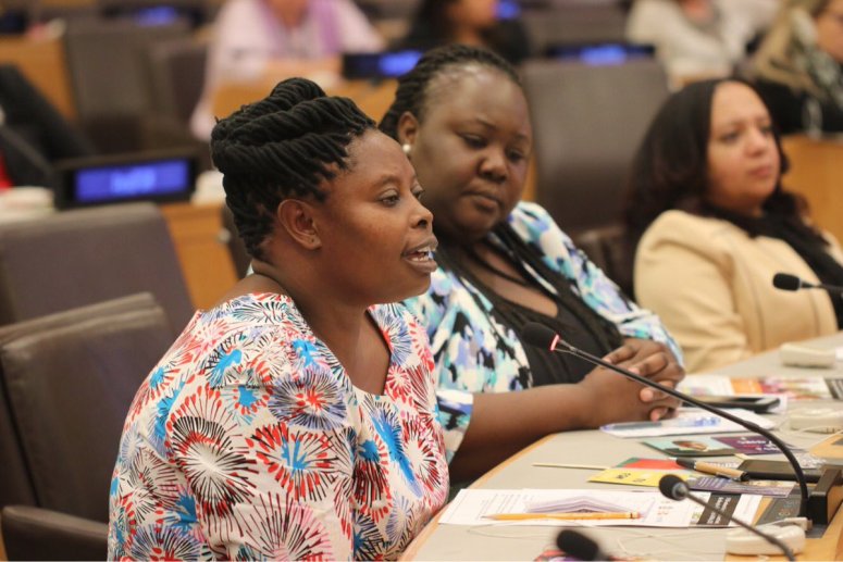
Last week Rhobi was invited to tell her story as an FGM survivor and activist at a high level panel as part of the United  Nations General Assembly in New York.  She spoke movingly about begging her parents not to cut her, as she feared dying and her body being thrown in the bush to be eaten by wild animals, as had happened to her friend Sabina.  But her pleas were in vain and she was cut and nearly bled to death.  She has since dedicated her life to saving other girls from a similar fate.

You can watch a recording of her testimony here.

The following day Rhobi participated in our mapathon at UNFPA where we explained how better maps can help activists like Rhobi quickly find girls at risk of FGM and showed people how they can help to create them.  There were side events in over 60 countries as part of this global FGM event, including at the Ministry of Women in Somalia, and with FGM activists in Kenya, Guinea, Mali, Niger, Uganda, Djibouti and many more.  Together they mapped over 49,000 buildings and almost 7000 km of roads to better protect girls at risk.

DoI0MZRU8AAfIJg

At UNFPA Tyler and Rebecca from HOT also explained how maps can be used for many humanitarian purposes.  You can see the presentation here. 

And now Rhobi is in London for the UK premiere of the film about her work, In the name of your daughter.  For those of you near London, Nottingham or Yorkshire I hope you may get the chance to watch it and to meet Rhobi.

Join our mapathon at the United Nations!

Its been a very exciting summer for Crowd2Map!

In July we were awarded the best Africa mapping project at the global State of the Map in Milan.

In August we gave a very well received key note at the global FOSS4G in Dar es Salaam, as well as another presentation and 2 workshops.  The conference was so impressed with our work that they decided to give the conference surplus of $15,000 to us to continue promoting mapping groups in rural Tanzania.

And now in September we have been invited to organise a mapathon at the United Nations General Assembly to demonstrate how mapping can help in the fight against FGM.  To coincide with this we are also organising a global online mapathon, details here.  We hope to build a global network to unite people from across the world to help map areas where girls are at risk of FGM so that activists can better protect them.  Please promote in your networks and join us! Together we can #map2endFGM

Success at State of the Map, Milan

We were delighted to be asked to talk at State of the Map in Milan, our presentation is here.   We also were on the panels on Sustainability of mapping projects, the Humanitarian OpenStreetMap microgrants, which we were delighted to receive last year, and the Open Gender Monologues, at which we spoke at some of the additional challenges faced by female mappers in rural Tanzania and what we are doing to address them.  You can see the whole programme for the conference here and watch the presentations online here.

SOTM award

At the end of the conference the OpenStreetMap Foundation presented their annual awards and we were delighted to win in the Africa category!

Interested in Open Data or Coding? Join us at MozSprint in May!

We are delighted to have been selected to participate in the Mozilla Open Leaders programme, particularly as Crowd2Map started at Mozfest, (the Mozilla Festival) in 2015.  As part of that, we are taking part in #MozSprint, their global hackathon.  There are around 65 locations around the world taking part, and you can also participate remotely online.  If you are interested please register here. 

We are hoping to get more people involved generally in mapping, validating and spreading the word, but particularly in the more technical aspects such as helping improve the fieldpapers process, work out how best to incorporate machine learning into our mapping and how to better automate some of our processes.  Our repo is here.

So if you are interested in any of that please sign up and get involved!  And please spread the word in your networks too!

Open Data for Development event in Mwanza

To commemorate Open Data Day on March 3rd, Crowd2Map and Humanitarian OpenStreetMap Team(HOT) Tanzania organised a free 3 day training conference on how Open Data and Mapping using OpenStreetMap can aid development in Tanzania.  Over 90 people from across Tanzania attended the event at the Institute of Rural Development Planning in Mwanza, including community mapping groups from Kigoma, Kagera, Mara and other regions, students from IRDP Mwanza and Dodoma, as well as representatives from Tanzania Red CrossTanzania Wildlife ServiceUwezo and many other organisations.

The training was delivered by Amelia Hunt and Johannes Peters from HOT and covered topics such as what open data is available in Tanzania, what is OpenStreetMap and how it can help Tanzania; how to map your area using satellite images on a laptop; free apps on your phone; and printed Field Papers;and how to create printed village and district level maps. There were a combination of demonstrations, talks and practical workshops, including a session mapping in the field in the area around the campus.  Community groups who have benefited from phones and laptops provided by a HOT microgrant and the Nethope programme learnt how to make the best use of this technology to put their communities on the map for better navigation, planning and development of their areas.

There were also talks by Jonarda Ngissa from Uwezo  Tanzania on their citizen led educational assessments, and from Neema Meremo from Hope for Girls and Women Tanzania on how mapping can help protect girls from Female Genital Mutilation.

Evaluations showed that people had learnt a great deal from the training and comments included “it will help me be a better planner for my country”, “now I can teach others to improve our development” and “mapping is useful to indicate which water points are functioning, so we can improve access in Tanzania”.   Everyone indicated they would like further such training, and so we hope that many will be able to attend FOSS4G and HOT conference in Dar es Salaam in August.

Volunteering Opportunity for University Students

Are you in a Geography or International Development university department, wanting a real life example of how mapping can help rural African communities?

Who are we?

Crowd2Map Tanzania is an initiative created and managed by the Tanzania Development Trust. There are many missing maps in rural Africa. We have made it our mission to add as many OpenStreetMaproads and buildings to rural Tanzania.

Our goal

Our efforts have resulted in creating better maps which help humanitarian aid agencies, but especially vulnerable girls. Girls in Tanzania are at risk of being genitally mutilated (female gender mutilation/ FGM), and our maps help them find safer routes to and from schools.

Join us – fill in the form below please

How you can help

We offer you an opportunity to do remote (online) mapping (psst… there are additional, related opportunities when you join us). Whether you have 1 or 5 hours a week to assist us, we need you! Please join our growing community of international volunteers. Some of them are on the ground in Tanzania, and we’ll encourage you to work with them through our various communication channels. We use a combination of satellite and field mapping and validation in our approach.

What is in it for you?

As a student in geography, topology, geology; in humanitarian studies and international development work, you’ll be giving us the kind of insightful and motivated help we are looking for. In turn, we’ll reward you with a badge and/or certificate honoring your volunteering contribution. And: You will expand your international network online for future opportunities. Volunteering opens doors!

Additional opportunities

Once you connect with us, we’ll have further opportunities. For instance: You may want to deliver training sessions on OpenStreetMap. You may want to take part in our competition to create a printed map of a village. Or you may be interested in forming a YouthMapper chapter.

Come on… join us!

Welcome to the mapathon everyone!

We’re trying to break the record of the biggest mapathon ever for the 13th anniversary of OpenStreetMap, and it is now LIVE!

The mapathon will last until 11am UTC tomorrow (August 14). We are mapping here http://tasks.hotosm.org/?sort_by=priority&direction=asc&search=Tanzania+Development+Trust

There are instructions here: http://bit.ly/MapBuildings

PLEASE TRY TO ADD AT LEAST ONE BUILDING DURING THE NEXT 24 HOURS. AND TELL ALL YOUR FRIENDS!

We are hoping to beat the record for most mappers involved within 24 hours. You can check whether your edit has been counted. http://bit.ly/Crowd2MapTracker