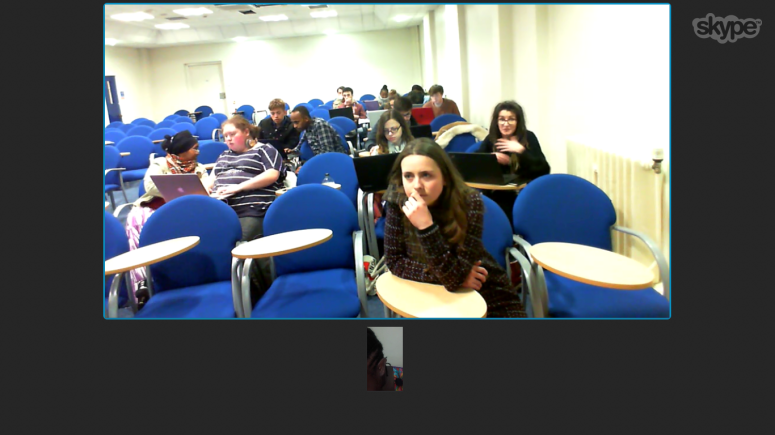
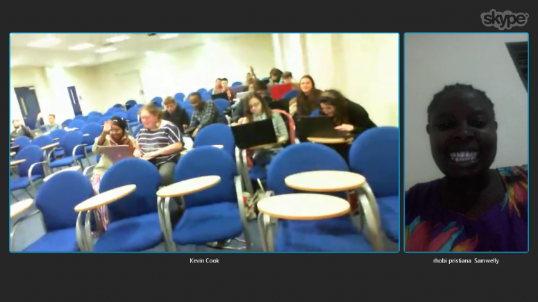
Last month Egle (@seplute) held a mapping session over Skype with Northampton University student group. The students quickly got hooked on mapping, claiming that it was “really addictive”, and mapped a few hundred buildings in the hour or so of mapping! We had Rhobi join us to answer questions about FGM as well, and the students were really engaged.
Find some screenshots below & our slides are here: http://www.slideshare.net/seplute/crowd2map-northampton-university-mapping-session
If you’d like to set up a similar workshop in your university or community, please get in touch!
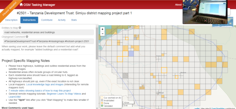
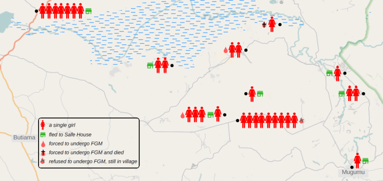
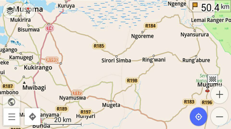
Anticipated for December, we have received word that the FGM season has started already in the Mara region of Tanzania. We are rushing to map two tasks that will help Mugumu Safe House workers to identify & reach villages at risk:
Crowd2Map had a great time presenting at Mozfest in London last weekend. We had a session in the science fair on Friday night and signed up a lot of new people to help map the area of Serengeti where girls are most at risk of Female Genital Mutilation via mapping from satellite images here. Then we delivered a workshop on Sunday to actually get people mapping (all the notes from the session can be found in the Etherpad here), complete with a live link to the Safe House in Mugumu, and presented our map at the show party on Sunday.
Coupled with doing 4 interviews, meeting hundreds of amazing people and even being chased by monks it was a brilliant weekend. BUT, on a serious note, we are desperately trying to get the map of Serengeti complete before the FGM cutting season starts in 3 weeks time. Please help us here.
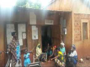
Received a note from Wambura Kisika, the legal officer at the Mugumu Safe House! Here it is, in his own words, why our mapping is helping their crucial effort to fight FGM:
On our side we are doing fine at the safe house. The map is very important because most of the villages where the girls come from are remote areas, there no passable ways, no bridges for the rivers, settlements are scattered and some areas with some dangerous animals, so as can remember we are working with volunteers who informs us about the incidents in villages, during the cutting season when we are informed of the incident we have to know the road to that particular place which is passable, the volunteers also should know the road where we can meet and the girls also have to know the road to the safe house. Currently we using the map to reach some place where we never reached before, educating them about the effects of FGM and making demonstration for those who would like to run to the safe house during the cutting season we are also thinking to use the map distance to plan the fuel budget for collecting some girls who will fail to reach the safe house and during returning them back home…
8 mappers in Vilnius, 26+ in London, 32 in Dar, 15 in Nairobi, 15 at Mugumu Safe House and many others online joined our mapping party last Saturday!
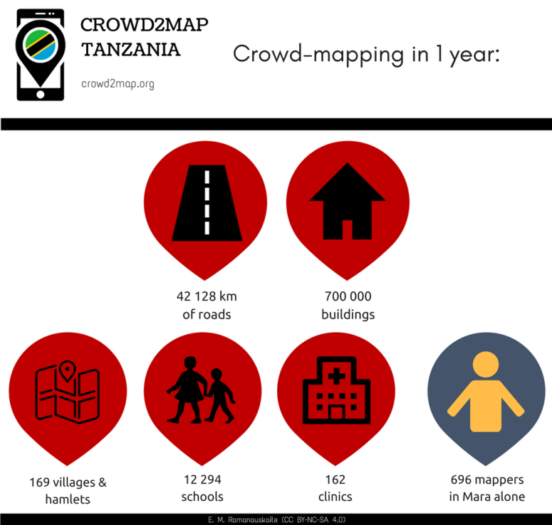
Thanks to all of you we were able to map over one third of the entire region in Mara!!
Congratulations all users who were able to map an amazing number of squares. You can also check your own contribution on roads and buildings here.
Thanks also to Polyglot and robert, who have been validating our squares so far !!
I’m not so good with numbers though, and frankly, I don’t think they speak justice to what we have accomplished during our Triple Mapping Party! So I am going to tell the rest of the story in notes and pictures instead…
Great work, I am with you from Zeze village – Benedicto
…and Tunapanda from Nairobi! Thanks so much guys!!
15 of us learning to get our map on in Kibera, Nairobi – Jay
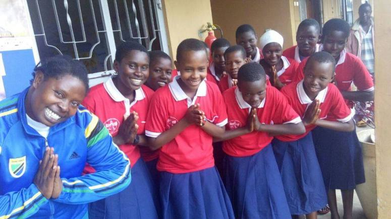
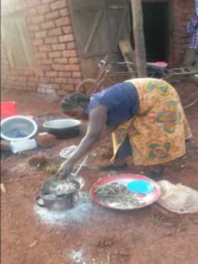
Girls at Mugumu Safe House took matters into their own hands and joined us in mapping all day!! Thanks to Rhobi who takes care of the safe house, IT teacher Irene, roadshow Emanuel & the girls at the safe house!
We are very excited to map our Tanzania, here with Madam Rhobi – Irene
Congratulations everyone who participated in the mapping! Hongereni Sana! – Rhobi
We ended the session with so much smile – Irene
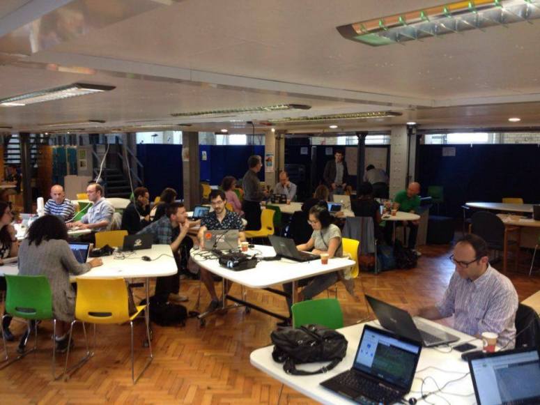
More mappers in London!
London in action – Andrew
Happy mapping in Dar!
And finally…
Appreciations and so much thanks from the Safe House for great experience acquired during mapping – Rhobi
Remember: NOW is only the beginning… we’ll continue to map together, part of Crowd2Map Tanzania!!
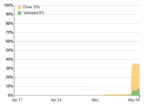
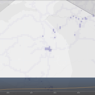
Thanks to some nifty tools recently developed in the OSM community, we’ll be able to visualize our impact with OSM analytics!
Playing about with it just now, I discovered that already a noticeable amount of work has been done in 2016, partially thanks to our mapping volunteers!! Blank canvas is already turning into something resembling a map, see for yourself:
Roads before 2016:
… and now (4 months into 2016!):
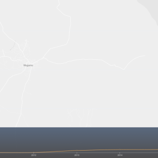
Buildings around Mugumubefore 2016:
… and now (4 months into 2016!):
We hope our Mapping Party will paint that into a multitude of colours!
Which team will map the most? Vilnius? London? Dar?
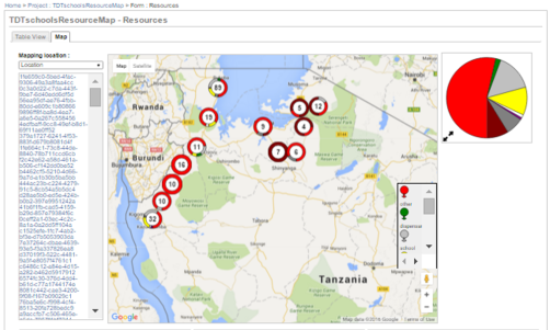
Crowd2Map used to be run via EpiCollect+ platform, which allows locals to install an app on smartphones or tablets and register various resources and villages through a simple data collection form. By setting coordinates, attaching a photo and answering a few questions, each point can be registered in minutes.
The data is then sent to the central server, and all the data points can immediately be visualised on a map via the browser:
In December 2015, Janet took some donated tablets and smartphones to several schools in Tanzania and kicked-off the data collection. Several months past, we already have over 200 points!
[update 2016-04-10] We now have nearly 1500 pointson EpiCollect+!
hanks to the efforts of our amazing mapping volunteers during our Women’s Day challenge, we have gone through more than 200 entries of Mara primary schools, and 173 schools now appear on a public Open Street Map!
Current map of Primary schools in Mara region of Tanzania:
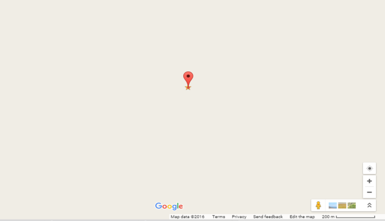
“Before” shot – none of these schools appeared on Open Street Map before March 8th 2016! :
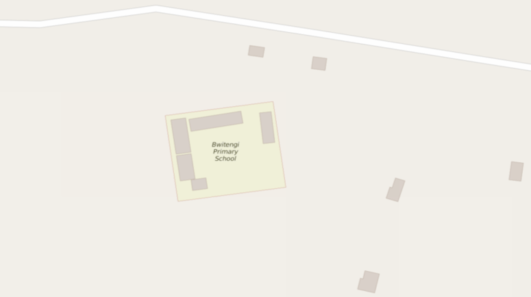
“Before” shot of Bwiterngi Primary School at -1.89519, 34.66128:
Bwiterngi Primary School (-1.89519, 34.66128), along with 170+ other schools now located on Open Street Map, and can be looked up by name! :
This work will greatly support the outreach efforts in the areas at risk of FGM and help take the girls to save havens, such as Mugumu Safe House.
All thanks to *all of you* who contributed your time and clicks on your laptops!
The effort will go on to map the rest of the Primary schools, Secondary schools and dispensaries in Mara, as well as other regions of Tanzania long-term! (Find instructions for participating here.)
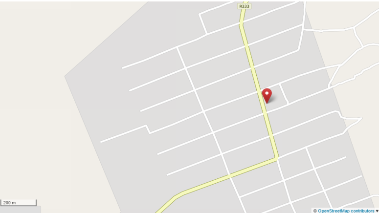
Putting Zeze on the map – a post by our friends MBONI YA VIJANA youth community in Zeze – paints a picture of the Zeze village, as well as documents the very beginnings of the Crowd2Map Tanzania, and how we hope to literally put it on the map. Why is that so important? Well, see for yourself:
This is how Zeze Village looks on Google Map at the moment: (marked point is the village market, -4.89913606, 30.0578204)
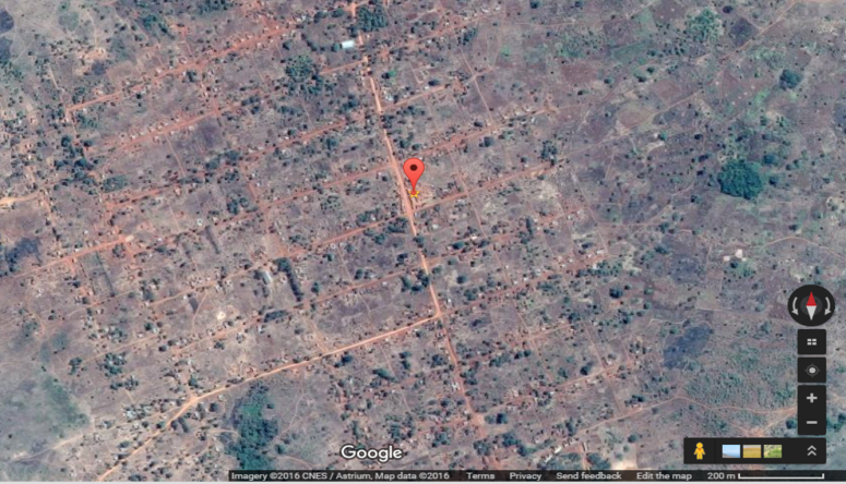
This is how it looked liked 6 months ago on Open Street Map: